From Snowpack to Surfing: How Arkansas River Flows Are Managed
How Streamflows Are Managed on the Upper Arkansas River
The Arkansas River in Colorado is a unique and vital waterway. As one of the major rivers flowing off the east side of the Continental Divide, it has long played an essential role in delivering water to the Front Range and eastern plains of Colorado.
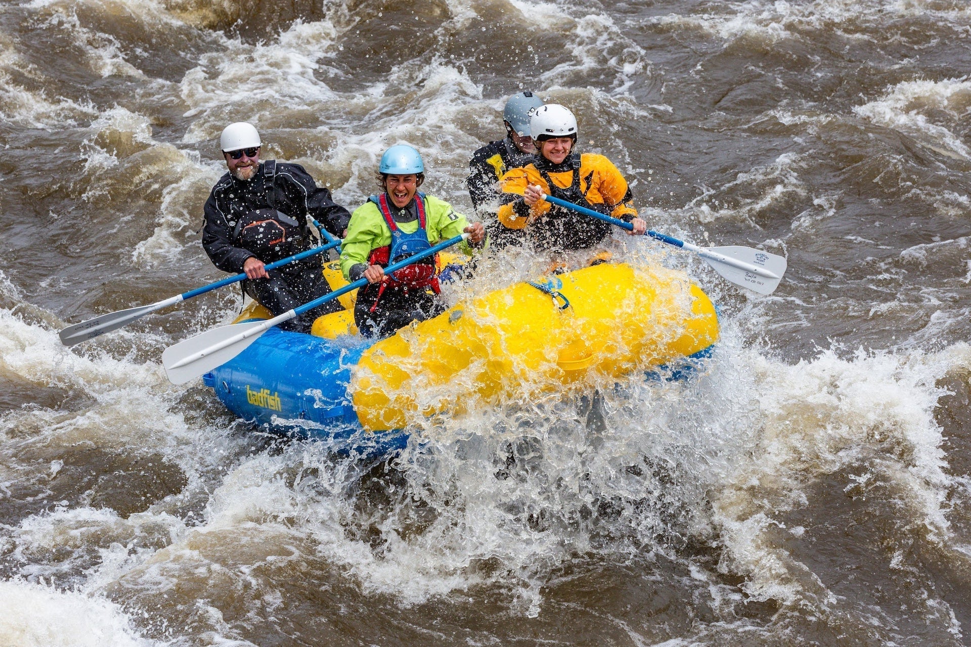
Combined with nearly 100 miles of world-class whitewater between Granite and Cañon City, the Upper Arkansas is also a major driver of the state’s outdoor recreation economy.
A Problem of Colorado's Geography
In the 1940s, Colorado water planners faced a simple but confounding issue: most of the snow falls on the west side of the Continental Divide, while most of the people and farms are on the east.
To solve this, the Fryingpan–Arkansas Project was proposed. Named for the Fryingpan River near Basalt (a tributary of the Roaring Fork), the project aimed to divert water from the western slope and deliver it to the east via the Arkansas River.
The mid-20th century was a golden era for large-scale water projects in the American West. Since most of our water supply comes from melting snowpack, politicians and engineers of the time embraced the philosophy of bringing water to people—not the other way around. Massive dams and reservoirs were constructed to overcome the challenges of geography.
Trans-Mountain Diversions And The Arkansas River
The Fryingpan–Arkansas Project is what's known as a trans-mountain diversion—in other words, moving water from one side of the Rockies to the other. While most diversions use gravity to do the work, trans-mountain diversions require complex infrastructure to make water flow “uphill.”
Approved in 1962 and largely completed by the mid-1970s, the project now delivers non-native or “imported” water to the Arkansas River, making average flows higher than they would be if we relied solely on local snowpack.

A Boating Economy Emerges On The Arkansas River
The Arkansas River’s recreational significance took root in 1949, when the first FIBArk (First in Boating on the Arkansas) festival was held in Salida, Colorado.
Hosted for visiting European kayakers, it sparked a whitewater legacy. By the 1970s, commercial rafting outfitters were running trips, and by the 1990s, whitewater rafting had become big business.
Today, rafting brings nearly $100 million in economic impact to the Upper Arkansas River Valley, with more than 250,000 people rafting the river with outfitters each summer.
Managing River Flows for Recreation
In the early 1990s, the State of Colorado partnered with the Bureau of Land Management (BLM) to create the Arkansas Headwaters Recreation Area (AHRA) to manage the Upper Ark. Around the same time, commercial rafting interests recognized that imported water—referred to as “project water”—could be better timed to benefit the recreational economy.
This led to the creation of the Voluntary Flow Management Program (VFMP)—yes, another acronym!
Under this agreement between the Southeastern Colorado Water Conservancy District and upper basin agencies and non-profits, water is released from upstream reservoirs (like Twin Lakes) to downstream ones (like Pueblo) on a schedule that supports and extends the whitewater season.
The key benchmark of the VFMP is this:
-
After July 1, if flows drop below 700 cubic feet per second (cfs) at the Wellsville gauge downstream of Salida, the Bureau of Reclamation (BOR) will release additional project water to maintain 700 cfs until August 15.
What Does That Mean for Paddlers & Surfers?
In an average year, paddlers and surfers benefit from higher flows thanks to this imported water. In big snow years, the river often stays well above 700 cfs on its own, and managers might focus instead on not over-releasing when flows top 3,000 cfs. In dry years, the BOR might reduce the target below 700 to stretch the limited imported water further.
The most important point: the VFMP is a voluntary agreement. Water users are simply coordinating their already planned releases to better align with recreational interests. If the snowpack is low, they can’t release what they don’t have. And while there's a great deal of cooperation between stakeholders to support recreation, the water always belongs to someone—whether it’s for crops or municipal supply—and those uses will always take priority over recreation.

Post-August and Winter Flow Bumps
On August 15, augmentation typically ends, and the river returns to native flows. That often means flows drop below 400 cfs within a few days—sometimes significantly lower.
Water is also moved during the winter months to make room in upstream reservoirs for the following year’s imports. Sometimes this is coordinated with fishery needs if overwintering brown trout eggs are in danger of freezing or drying out due to low flows. These releases have the added benefit of creating better winter surf conditions.
Again, this depends on last year’s snowpack and current water forecasts. Some years we get the bump, and some years we don’t.

Imported Water Makes The Arkansas River a Hub For Whitewater Recreation
For those of us who love to paddle or surf the Arkansas River, we owe a huge debt to the Fryingpan–Arkansas Project; a project conceived decades before anyone imagined whitewater recreation as a serious economic engine.
Today, the Arkansas River is exactly that: an engine of economic impact for our mountain communities. And thanks to smart, cooperative flow management, we continue to enjoy one of the best stretches of river in the country through an extended season.